
Work a South Euclid Street by Address
A South Euclid street directory is a route through several keyed systems, not a roll of everyone on a block. Start with the exact address in Cuyahoga County MyPlace. Select City, choose South Euclid, then select Address. The result can supply the situs address, owner field, permanent parcel number, transfers, tax path, document list, and map connection. The owner field is useful for tracing a recorded interest. It does not establish all people who live at the address.
- Search the property by address and preserve the displayed South Euclid situs, owner, transfer clues, and PPN.
- Open View Map or Advanced Map, then pan and click each parcel separately if the question involves other lots on the same street.
- Use the PPN, address, legal description, or party name in the Recorder search to find a conveyance or other recorded document.
- For a person-specific voter check, use Ohio Secretary of State My Voter Information with first name, last name, and Cuyahoga County. No official street-first block roll was located.
- For an earlier adult address listing, consult the criss-cross material through the Cleveland Public Library directory guide and compare its year with the parcel and deed trail.
That order keeps the property trail separate from an address listing. It also gives a repeatable way to examine several South Euclid addresses without treating a street name as proof of a household.
Use South Euclid MyPlace Modes
MyPlace accepts three county-documented entry modes: Owner, Parcel, and Address. City is optional but should be set to South Euclid to reduce same-name results elsewhere in Cuyahoga County. The search text follows the selected mode. Once a card opens, its General Information, Transfers, Permits, Tax By Year, Get a Document List, and map paths make it a practical street-directory starting point. County guidance treats the online compilation as a free public service, not the legal official record.
| MyPlace field | Control | Street-directory use | Format or limit |
|---|---|---|---|
| City | Dropdown | Narrows the property universe to South Euclid | Optional; the default is Entire County |
| Search mode | Radio choice | Choose Owner, Parcel, or Address | One mode is required |
| Search text | Text field | Supplies the name, PPN, or address for the chosen mode | Use the convention for that mode |
| Download Addresses | Result control | Appears with results | Check the current portal terms before relying on it |
After selecting a parcel, the Treasurer’s Tax By Year instructions explain where bills, available payment history, and balances appear. Those records concern the parcel and its tax account. They are not an occupancy ledger.
The County’s property-tax instructions show the MyPlace route to Tax By Year after a parcel is selected.
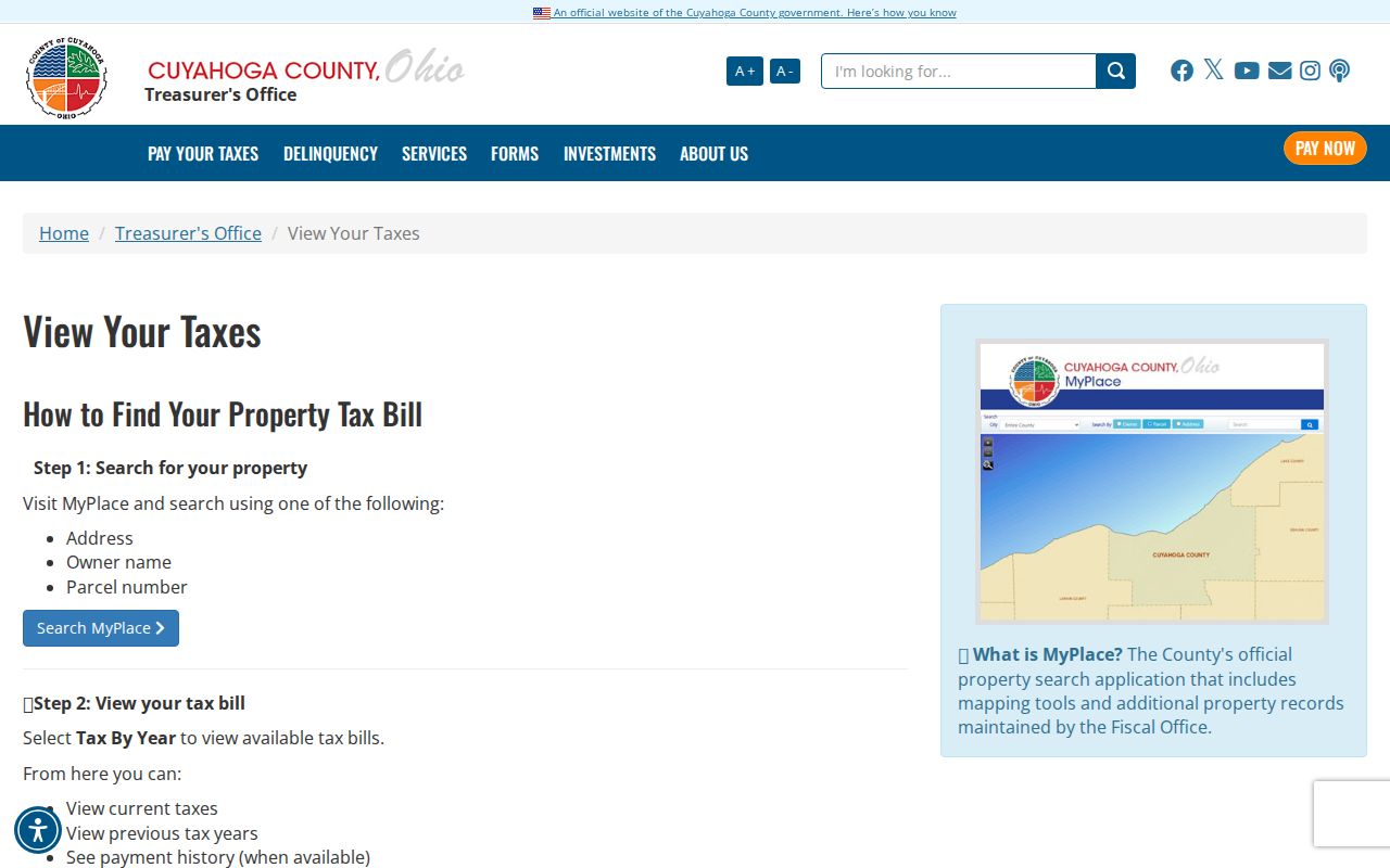
The tax screen complements the parcel trail with bill and payment context where available, but it does not turn a mailing field into evidence of occupancy.
Keep South Euclid Parcel Terms Straight
Address research gets more durable when the parcel reference travels with the street number. The Fiscal Office’s Maps & Digital Imaging page describes the permanent parcel number as 000-00-000, meaning map book, page, and circle. That identifier can bridge a changed street description and helps distinguish similarly named owners or streets.
- Parcel
- A defined piece of land in county property records, identified here by its permanent parcel number.
- Situs address
- The physical location assigned to the parcel. It is different from the address used to send a tax bill.
- Tax mailing address
- The bill-delivery address for a taxpayer. It can differ from the situs and does not show who occupies the property.
- Legal description
- The lot, block, subdivision, section, condominium, or similar land description used to match records when a street address changes.
- Criss-cross directory
- An address-oriented directory that can identify adult listing(s) at a covered address for a particular volume year.
Map Room staff can research prior ownership for roughly 40 to 50 years. A displayed transfer may also reflect a refiling, name addition, or transfer-on-death event, so it should not be read automatically as a sale or a move.
Move South Euclid PPNs to Recorded Documents
The Cuyahoga County Official Records Search Advanced Search is the precise next stop after MyPlace. Its Property Records form offers party names, grantor, grantee, recorded and instrument date ranges, document type, document number, parcel ID, volume/page, property address, document-image phrase, and subdivision, section, or condominium legal paths. Parcel IDs must include dashes. Compare the PPN, legal description, dates, and document type before deciding that a result belongs to the South Euclid parcel.
| Recorder field | Input | When it helps | Local note |
|---|---|---|---|
| Party Names, Grantor, Grantee | Token text | Follows the parties in a conveyance | Use last name first and press enter to add a party |
| Property Address | Text | Begins with a South Euclid address | Verify against PPN and legal description |
| Parcel ID | Text | Connects a parcel to recorded documents | Include dashes, such as 000-00-000 |
| Recorded or Instrument Date | Date pair | Separates filing date from document date | Use MM/DD/YYYY |
| Legal description | Selectors | Resolves changed or unclear address wording | Subdivision, section, and condo paths are available |
The index reaches documents from 1810 to the present. Search is free, but confirm current image and copy access through the portal or counter. Index-only mode handles multiple entered words individually; Index & Full Text OCR treats them as a phrase. OCR can help locate a document, but it does not replace a check of the indexed details or record image.
Note: A Recorder result documents a filing and its parties, not a present household or a date someone moved.
Map South Euclid Parcels, Not Households
The Cuyahoga Fiscal GIS Hub and MyPlace map connection are useful for locating a selected parcel, panning to nearby geometry, and opening a neighboring parcel’s own record. The documented mechanics are simple: search or select the focal parcel first, zoom or pan, click the neighboring parcel, preserve its PPN and detail, then verify owner or document information in the separate property record. The unattended map inspection did not capture dependable named layer or filter controls, so no particular layer button should be assumed.
Physical adjacency is the only conclusion the map supplies by itself. A parcel map does not establish a personal relationship, shared household, or current resident. Plat and subdivision information, then deeds, can explain the legal connection between the lot and a street.
Check South Euclid Address Actions
South Euclid’s Building Department points to Citizenserve for permits, planning and zoning, code enforcement, and general requests. It also identifies a current 2026 High Grass Violations interactive map. These are property-action channels. They may help date documented work, an enforcement item, or an agency interaction at an address, but they do not identify a present resident or settle ownership without the underlying record.
The Building Department page shows the city’s address-facing permit and enforcement resources.
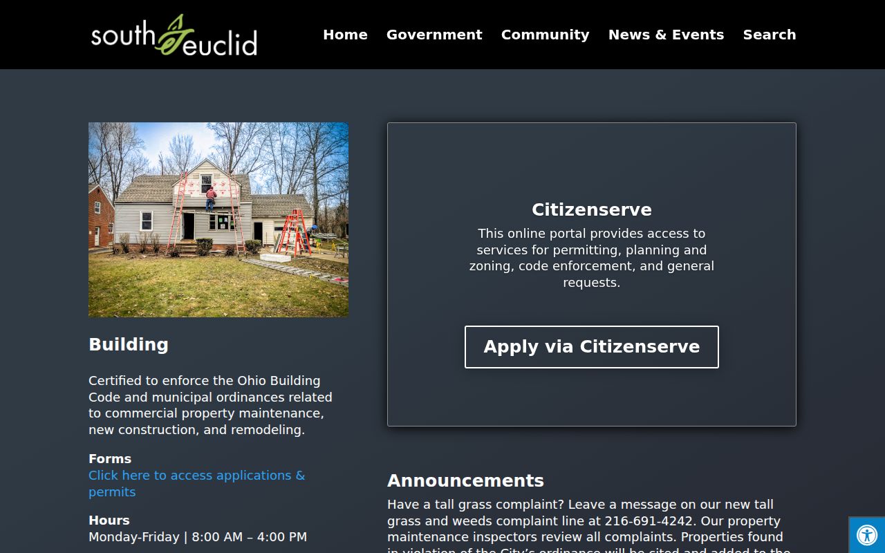
Use the city interface to locate a public project or action, then preserve the parcel and document context before drawing any conclusion about a South Euclid address. The 2026 high-grass map is an address-action layer, not a resident list.
Read South Euclid Street Court Hits Carefully
Some court tools accept address-facing criteria, yet their results remain case references. South Euclid Municipal Court CaseLook warns that online postings can lag at least 24 hours and directs users to written or in-person verification. The Cuyahoga Common Pleas Case Records Search includes Sheriff Service and Foreclosure functions with street, city, parcel, ZIP, party, or case criteria depending on the form. A case connected to a street is not evidence of current ownership or residence.
When a record must be checked, compare the case number, party name, filing dates, and case type, then use the proper clerk or court request route. Court systems are custodians of their own files and may limit remote display or redact protected material.
Find Historic South Euclid Street Listings
For older adult address listings, Cleveland Public Library’s criss-cross material fills a different role from the current parcel record. The Library’s guide documents a Cleveland address section from 1929 and a Haines Criss-Cross run from 1960 to “last year,” plus 1923 and 1926 editions. The dedicated South Euclid directory sequence covers 1949 through 1963, followed by the East Suburban Directory through 1980. The historical volumes themselves are best handled through the South Euclid Directory Book, rather than treating them as current property data.
Directory entries can list adults at an address for a given edition and may include name, occupation, or telephone context. They do not name every household member and do not prove continuous residence. Match a listing to its volume year, then compare it against a deed or map chronology.
Bridge South Euclid Street Names
Old address research needs a continuity file, not a guess about renumbering. County Archives cautions that street names, dimensions, and property descriptions can change. Preserve the address as written, current PPN, historical legal description, subdivision or lot/block language, and a relevant map or atlas. That combination is safer than matching a street number alone.
Case Western Reserve University’s street-names history documents a 1906 and 1907 old/new-name bridge for numerical address listings associated with the Cleveland grid. It is a useful countywide bridge when a historic directory fails. South Euclid was part of Euclid Township before its 1917 village formation, so earlier material may be cataloged under Euclid Township, a county/suburb title, or a Cleveland-area series. No verified South Euclid-specific citywide renumbering date was found, and none should be inferred.
South Euclid Records Along a Street
Each address-keyed layer answers a separate question. The most reliable South Euclid street directory workflow retains the PPN and legal description as it moves from a property card to recorded documents, maps, and older address sources. The table distinguishes what each channel can actually show from conclusions it cannot support.
| Address record | Custodian or path | Useful street result | Boundary |
|---|---|---|---|
| MyPlace assessment | Cuyahoga County MyPlace | Parcel, owner and mailing fields, values, transfer and tax paths | Does not list all household members |
| Recorded documents | Fiscal Officer Transfer & Recording | Document, parties, date, PPN, and legal-description clues | Does not provide a move date or occupancy proof |
| GIS and city address lookup | County GIS / City parcel tools | Parcel position and connected property information | Does not show personal ties among nearby owners |
| Building and high-grass resources | South Euclid Building / Citizenserve | Public project or enforcement address context | Does not establish ownership, liability, or residence alone |
| Criss-cross directory | Cleveland Public Library microfilm | Historical adult address listing for its edition | Does not show all occupants or current status |
Where a web result is incomplete, use the Fiscal Office, Recorder counter, Map Room, or County Archives rather than extending a search result beyond its documented meaning. The County’s public-records process under the Ohio Public Records Act / Sunshine Laws allows a request for an existing identifiable county record, subject to exemptions and redaction.
Set Limits for South Euclid Street Searches
A street search cannot reveal a complete roster of people living on the street. Utility customer records, DMV address data, delivery records, protected residents, and unlisted household members are not a public address product. Ohio’s statewide voter lookup is person-based, and no official public street-first tool returning a block roll was located. Its public-record fields and confidentiality rules must be respected.