
South Euclid Neighbors at Parcel Level
A defensible block search begins with a focal parcel, not a name list. County mapping and MyPlace can show the focal lot, its physical neighbors, and the separate assessment record for each lot. The Recorder can add dated deeds and plats. City records may add an address-linked permit or code action. Each source answers a narrow question, which keeps an adjacent parcel from being mistaken for evidence about everyone who lives there.
| Source | What It Shows About a Block | Access |
|---|---|---|
| MyPlace and county GIS | Focal parcel, physical adjacency, and each parcel's assessment and owner fields | Map browse and click, then open each record; mailing address does not establish occupancy. |
| Recorder, plat, and deed index | Legal lot, block, subdivision, recorded parties, and document dates | 1810 to present index; an ownership history is not a household chronology. |
| County Archives tax and map holdings | Historic building, lot, and owner context | Appointment or research request; coverage depends on the record era. |
| City Building and Citizenserve | Address-tied permits, zoning, code, or violation activity | Shows a project or action, not a resident identity or liability conclusion. |
| Board of Elections channels | Person-specific voter verification and a citywide data-file route | No official street-first public search that returns a block voter roll was located. |
| Community groups | Organization and contact layer | No current public household or member roster was located. |
Recorded owners can be useful context for South Euclid neighbors, especially where ownership stays with one parcel over time. They do not prove that the owner lives there, that a renter lives there, or that two people have a family or social connection.
Map South Euclid Neighbors Parcel by Parcel
Use the County GIS direct viewer or MyPlace View Map to move from one address to the nearby lots. The live map inspection did not capture named layer or filter controls, so the reliable method is deliberately simple: select the starting parcel, pan and zoom to physical neighbors, then open each nearby parcel on its own. Keep each permanent parcel number, or PPN, separate while reviewing owner and document information.
- Find the known South Euclid address in MyPlace with City set to South Euclid, or select its parcel on the map.
- Record the focal parcel's PPN, situs address, displayed owner, tax-mailing address, and transfer path.
- Pan or zoom to contiguous and nearby parcels, click one parcel at a time, and note its own PPN and assessment details.
- Open MyPlace or the Recorder for that individual parcel to review owner, tax-mailing, transfer, or document fields.
- Use the plat, subdivision, and legal-description trail if the block shape or address history needs clarification.
MyPlace searches by city, owner, parcel, and address. A tax mailing address can differ from the property situs, and neither field identifies every person at the address. For a chain along an entire named street, use the South Euclid street directory rather than treating a block search as a streetwide result.
South Euclid Neighbor Results Are Owner Records
The MyPlace property roll can display a parcel ID, owner name, situs address, tax-mailing address, values, and transfer or tax paths. It is a county compilation used to locate and compare property material, and the county says the online compilation is not the official legal record. The Recorder is the custodian route for the recorded instrument. A current owner field and a recorded transfer should be read together when a property question matters.
One address can carry several different kinds of information. Situs means the physical parcel address. The tax-mailing address is where a bill is sent. A legal description links the land to lots, blocks, subdivisions, sections, condominiums, or similar record language. The PPN bridges those descriptions. None of those fields creates a resident list, so a neighbor search should never infer an unrecorded household member.
Record boundary. Geographic adjacency establishes where parcels sit beside one another. It does not establish present residence, friendship, kinship, or permission to contact a person.
South Euclid Blocks Through Plats and Deeds
Plats and subdivision descriptions explain why a set of parcels belongs to one block, while deeds add recorded parties and dates. The Cuyahoga Recorder's index reaches from 1810 to the present and its advanced search includes party, grantor, grantee, property-address, parcel-ID, legal-description, document-type, and date routes. A parcel's documents should be reviewed with that parcel's PPN and legal description, not copied across nearby lots merely because the street name matches.
For an older block, the County Archives holds tax duplicates from 1819 to 1986, original map volumes from 1860 to 1945, appraisal cards from about 1935 to 1970, and suburban atlases. These sources can show changing lot or building context. They should be used as historical property context, not as proof that a particular person lived on a block at a given time.
South Euclid Neighbor Voter Limits
Ohio's statewide voter search begins with first name, last name, and county. After an initial result, it can offer a street-name narrowing step. The Cuyahoga Board of Elections voter-information lookup instead captures last name and date of birth, then can provide city, ward, precinct, polling place, districts, and a declared-party-affiliation field. It is a person-specific verification path, not a way to begin with a street and receive a block roster.
Ohio law treats the registration forms and statewide voter database as public records with important exclusions, including Social Security, driver-license or state-ID, telephone, email, confidential-voter, and protected-worker information. Voting history means participation in an election, never a ballot choice. South Euclid city-district material is available through the Board, but the inspected page did not publish exact file columns. Request or inspect the existing file instead of assuming a block field exists.
South Euclid Neighbor Community Contacts
Current community resources are contact paths, not membership lists. Community Development can direct an address or neighborhood question to the appropriate city channel. One South Euclid is a local community-development organization. The Community Center schedule identifies organizations meeting there and offers an event and contact layer. None of these sources supports a claim about which households belong to an organization.
| Current contact | Role for a South Euclid block | Published access |
|---|---|---|
| Community Development | City community-development contact for local neighborhood questions | City Hall; Director Keith Benjamin; 216-691-4234. |
| One South Euclid | Local community-development organization | 4645 Mayfield Road; 216-396-9392. |
| South Euclid Community Center | Schedule and event-contact layer for organizations that meet there | Use the current city schedule; it is not a membership roster. |
The South Euclid Community Development page provides the current municipal contact layer.
Use that office for city-facing questions about local development or a neighborhood connection, not to request a private household list.
The South Euclid Community Center schedule identifies events and organizations that meet at the center.
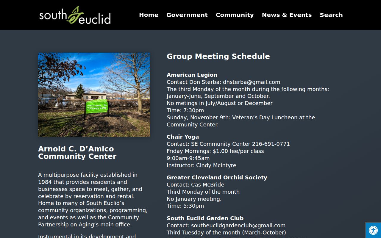
The schedule may name groups such as the South Euclid-Lyndhurst Historical Society, Garden Club, American Legion, or University Lodge, but meeting information is not evidence of individual membership.
South Euclid Neighbors and a Historical Guide
The archived City Good Neighbor Guide says neighborhood associations organized social and service events and directed residents to ask a councilperson or Community Relations whether a street had an association. It also described police help for block watches, safety presentations, and home-safety work. The guide is historical, so its contacts and program details should not be treated as current.
City archives also recorded staff support for organizing street clubs and associations in 2018. That history explains a community connection route, while the lack of a current official association or HOA household directory remains significant. Ask a current city contact about present programs rather than rebuilding a roster from an old guide.
South Euclid Neighbors: Official and Commercial Sources
Official records are narrow but traceable. The parcel and Recorder systems can show a specific property relationship, while elections channels verify a person through their stated fields and legal exclusions. Commercial neighbor-lookup categories may combine older public and private-source material, but their compilations can be stale, omit protected information, or confuse ownership with residence. No commercial service is recommended or linked.
| Source type | Best use | Critical limit |
|---|---|---|
| Official parcel and recorded documents | Confirm adjacency, property identity, recorded ownership, and legal lot context | They do not identify all residents or private relationships. |
| Official voter and city channels | Use a person-specific election check or request an existing public city file | No located official street-first block voter search exists. |
| Commercial neighbor categories | At most, treat as a lead to be verified independently | Accuracy, source age, and lawful-use limits are uncertain; no service is endorsed here. |
South Euclid Neighbor Privacy Limits
Renters, other household members, utility customers, delivery records, and DMV address data are not a public parcel-adjacency product. Ohio Safe at Home protects eligible participants through a substitute legal address and confidential voter registration, while qualifying public-service workers can seek redaction of home-address information. Those safeguards cannot be bypassed by combining adjacent-address results with another source.
Lawful use. Use South Euclid neighbor records for property curiosity, a community connection, family-history work, or personal safety awareness. Do not use an address search to watch, contact, intimidate, or target a person. Ohio's menacing-by-stalking and telecommunications-harassment laws apply to threatening or harassing patterns of conduct and communications.
A parcel map gives a limited, useful picture of land. Respecting that limit protects neighbors and keeps the local record trail reliable.